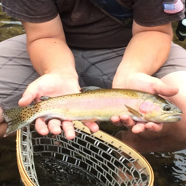

Fly Fishing The Tuolumne River
California
The Tuolumne River flows for about 150 miles from the Central Sierra Nevada, into the Joaquin River near Modesto, California. It's a very diverse river that has both freestone and tailwater sections with good populations of wild trout. The Tuolumne River system also consist of the South Fork of the Tuolumne River, a fine fly fishing destination itself, and the Middle Fork and North Forks of the Tuolumne River, which also have both wild and stocked trout. Both the main stem of the river
and its three forks have numerous tributary streams that also have good populations of trout. Fly fishing the Tuolumne River can range from easy to very difficult,
depending on which section of the huge river system you choose to fish.
The Tuolumne River is formed by the confluence of the Dana Fork, which flows from the 13,000 foot Mount Dana, and Lyell Fork, which flows from the 13,000 foot Mount Lyell, in the Tuolumne Meadows (elevation 8600 feet) in Yosemite National Park. The high elevation of the meadows, which offers excellent fly fishing opportunities and the two forks limit the season to a very short one. Dana Fork is accessible from Highway #120, which runs nearby from its head waters at Tioga Pass all the way to the streams confluence with the Lyell Fork. Brown trout represent the majority but rainbows and brook trout are also present the entire length of the stream. Lyell Fork flows approximately ten miles through Lyell Canyon to its confluence with Dana Fork. Cold Canyon and Conness Creeks join in on the flow below the meadows and the river flows through beautiful Glen Aulin Valley. From there the river flows into the rugged Tuolumne Canyon for a distance of about 25 miles and drops 4000 feet in elevation. Below the canyon, the river flows into Hetch Hetchy Reservoir. Return, Paiute, Rancheria, and Falls Creeks are more tributary streams.
Below the O’Shaughnessy Dam, the Tuolumne River also is an excellent fishery for trout. The discharges vary greatly and the fishing methods depend on the flows.
The Tuolumne River meanders through Poopenaut Valley before leaving Yosemite National Park and entering the Stanislaus National Forest. The Tuolumne River between Kirkwood Powerhouse and Don Pedro Reservoir is know as one of California's premier whitewater rivers. The South Fork of the Tuolumne River has both stocked and wild trout, with most of the wild fish off the direct road access areas. The river starts in the high country of Yosemite National Park and flows to where Highway #120 meets it. It flows through a deep canyon beyond this point, most of which is inaccessible.
The Middle Fork of the Tuolumne River starts at about 8000 feet and flows into the South Fork outside Yosemite National Park. Cherry Creek and Eleanor Creek both provide additional trout fishing opportunities. Cherry Creek is a fast water stream that flows out of the Emigrant Wilderness. Its headwaters are only accessible by hiking. It is dammed to form Cherry Lake and the tailwater section flows into the Middle Fork. It's mostly white water rafting stream but has plenty of rainbow trout.
The tailwater section below Hetch Hetchy Reservoir flows into Lake Don Pedro. Below Lake Don Pedro, you'll find even more fly fishing opportunities.
The North Fork of the Tuolumne River starts near Dodge Ridge and is followed closely by Highway #108. It flows through Stanislaus National Forest and as well as more private and public land before joining the main stem of the Tuolumne above Don Pedro Reservoir.